Empowering HTU YouthMappers: Training and Mapping Party with OpenStreetMap Ghana
Apr 10, 2023 | By James Amattey
OpenStreetMap Ghana and Ho Technical University Youthmapper Chapter and all chapters in Ghana held a mapping event to commemorate the 66th Independence Day celebration and create an up-to-date base map of buildings and missing roads in Ho on OpenStreetMap.
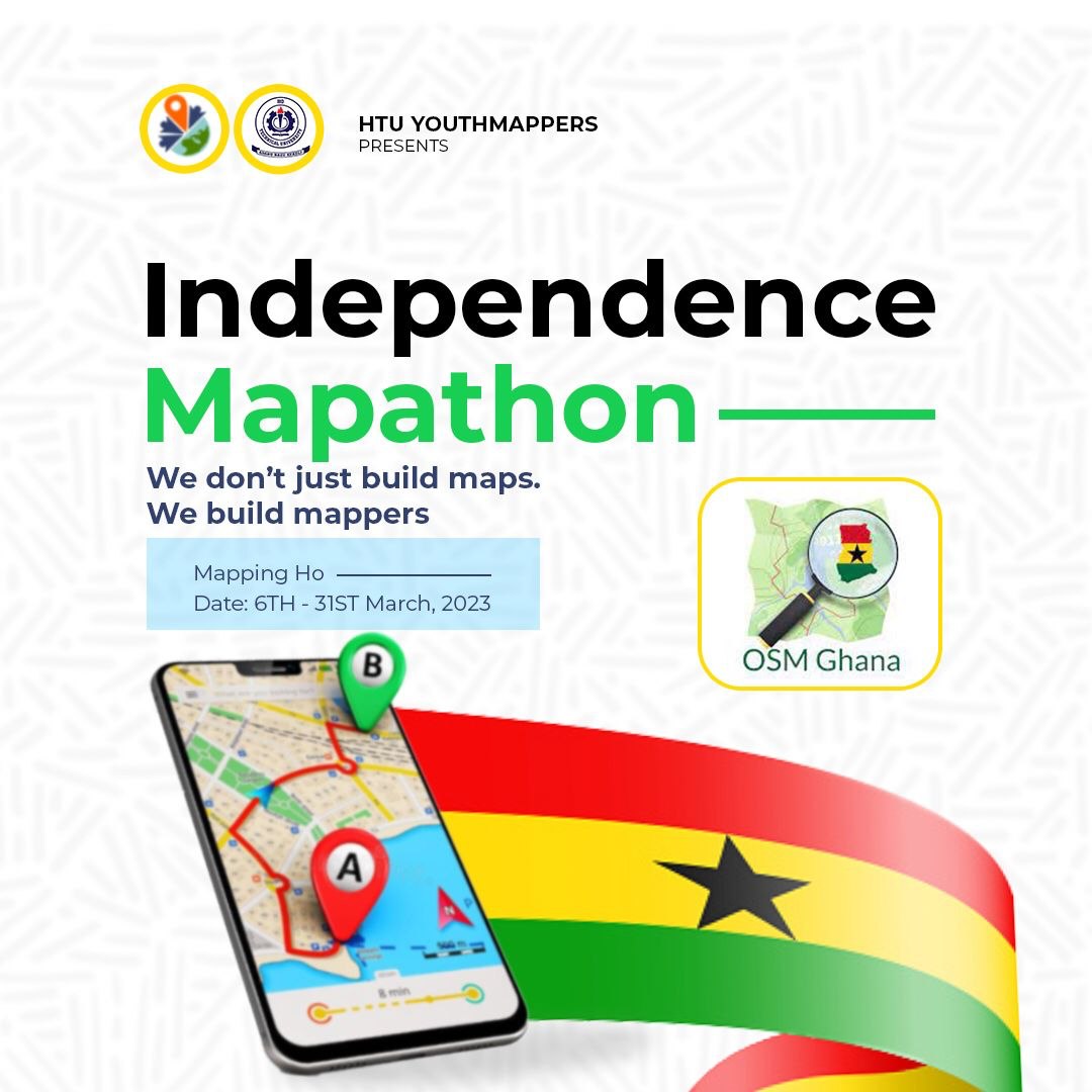
In a vibrant city nestled amidst the lush green mountains of Ghana lies Ho; also referred to the oxygen city of Ghana, home to the Ewe tribe and renowned for its breathtaking landscapes and rich cultural heritage. However, like many cities worldwide, Ho has been facing the challenges of rapid urbanization and population growth. To address these issues and put Ho on the digital map, a remarkable initiative named the ‘Independence Mapathon’ was recently carried out; This mapping exercise coincided with the celebration of Ghana’s 66th Independence Day
Led by the dynamic team of OpenStreetMap (OSM) Ghana, this initiative saw a collaboration that spanned continents. The OpenStreetMap Ghana team, based in Accra, embarked on a journey to Ho to join forces with the HTU Youth Mappers at Ho Technical University. Their mission? To equip the local mappers with the skills and tools they needed to properly map their city, identify common errors, and make a lasting impact.
The training session began with a comprehensive introduction to OpenStreetMap, the world’s free and editable map of the world. The team from Accra guided the eager participants through the process of digitizing building footprints using the iD editor in the browser. This user-friendly tool allowed the young mappers to start creating their digital footprint of Ho’s infrastructure, from roads to buildings.
However, the training didn’t stop there. The team delved into the more advanced JOSM (Java OpenStreetMap) application, giving participants a glimpse into the world of professional mapping. Armed with these tools and newfound skills, the local mappers were poised to make a significant contribution to Ho’s development.
After days of focused learning, the atmosphere transformed into one of celebration. The training culminated in a mapping party, a unique event where mappers came together not just to map, but to network, bond, and celebrate their shared purpose. Good music provided the backdrop, and the air was filled with the energy of collaboration.
Amid the excitement, participants took breaks to capture the moment with pictures and selfies, capturing the spirit of their shared achievement. The mapping party acted as a bridge, allowing the OpenStreetMap Ghana team to forge stronger connections with the mappers in Ho. The occasion was not just about mapping the city’s physical features, but also about mapping the bonds between the individuals who dedicated their time and skills to improve their community.
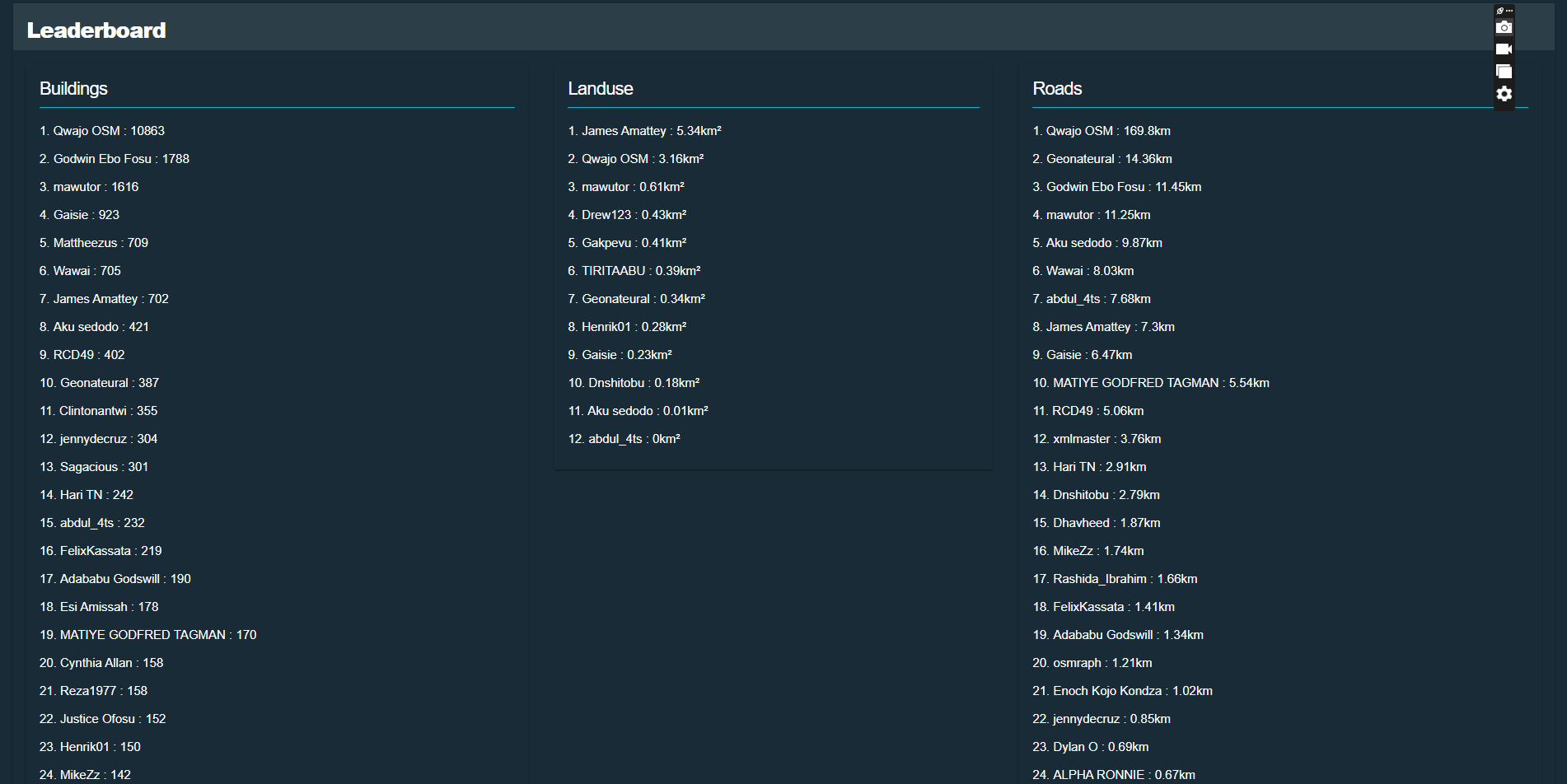
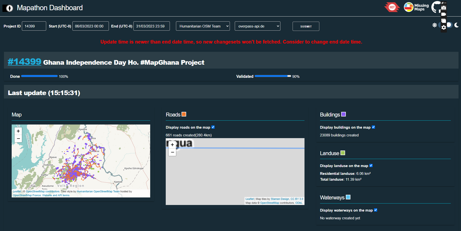
As the Independence Mapathon came to a close, the statistics spoke for themselves. Over 26,000 buildings had been digitally mapped, and more than 310 kilometers of roads had been added to the digital map. The project achieved a validation rate of over 90% in a short period, reflecting the dedication and precision of the contributors as we did not limit this contribution to the mappers from the Ho chapter by the YouthMapper community in Ghana at large.
In the end, the Independence Day Mapathon was more than just a mapping project; it was a celebration of collaboration, skill-sharing, and community spirit. The OpenStreetMap Ghana team and the HTU Youth Mappers had come together to empower Ho, both digitally and socially. Their efforts not only enriched the map but also enriched the connections and relationships that will continue to shape the city’s future. Through this process we identified some mapping challenges from the mappers which we carry with us to better curve and plan for other training in the future.
By the end of the project, we had achieved the following statistics
Number of Buildings - 26942 Kilometers of Roads - 746 roads created(310.5km) Residential Land Use in km2 - 6.08 km² Total Land Use in km2 - 11.41 km²
With the success of the Independence Mapathon and the sense of unity it fostered, Ho stands ready to face the challenges of urbanization with a digital infrastructure that reflects its vibrant culture and landscape, thanks to the dedication of its local mappers and the support of the OpenStreetMap Ghana team.